Sunday 29 / March / 2026
Muscat: Al Wusta and Dhofar Governorates are expected to be affected by heavy rains and high winds, with sea waves reaching maximum heights of 6 to 8 metres from Saturday, as Cyclone Luban gets closer to land, the Public Authority for Civil Aviation (PACA) has announced.
Read here: Dhofar schools, Salalah port closed over impending Luban
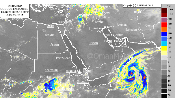
Officials revealed that the cyclone was 490 km away from Salalah.
In a statement online PACA said, “The latest weather maps and analysis of the National Centre for Multi-Hazard Early Warning indicate the concentration of the tropical storm Luban in the Arabian Sea. The wind speed around the centre is estimated to be around 64-74 knots/119-137 kmph. The cyclone is about 490 km away from Salalah."
Also read: Guidelines for residents in Oman to stay safe during natural calamities
The statement added, “The tropical storm continues to move towards west and northwest towards Yemen’s coast and part of Dhofar’s coast, with the storm likely to deepen into a tropical cyclone of the second degree within the next 48 hours.
“Forecasts indicate that Dhofar and Al Wusta governorates are likely to be indirectly affected from Thursday, October 11, 2018, with scattered rain and sea waves rising between 3-5 metres,” officials said.