Thursday 26 / March / 2026
Borneo: The scale of the tsunami hazard from volcanoes that collapse into the sea has been underestimated, according to experts.
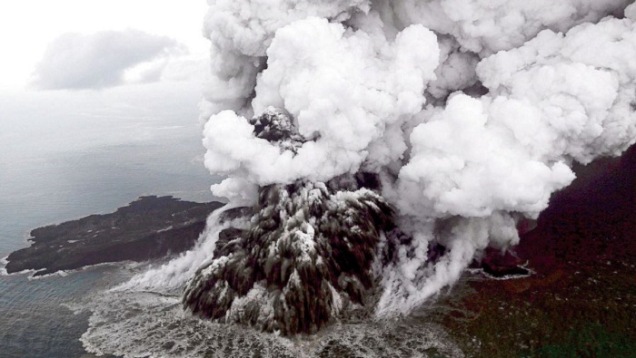
That's the conclusion of a new analysis of satellite pictures of Indonesia's Anak Krakatau showing the aftermath of its flank failure last December.
The study concludes that the volume of material that slipped into the water was actually relatively small.
And yet it generated destructive waves around the Sunda Strait as big as those expected from a much larger event.
More than 400 people died in the disaster on 22 December 2018; a further 7,000 were injured and nearly 47,000 were displaced from their homes.
Rebecca Williams from Hull University, UK, and colleagues have gone back and examined the satellite radar images that were taken of Anak Krakatau ("Child of Krakatau") before, during and after the volcanic activity that precipitated the flank failure.
Radar data was central to the analysis because this remote sensing technique can detect the ground surface even when it's dark, covered by cloud or, as in this case, obscured by erupted ash.
A key image in Dr Williams' study is one acquired by the EU's Sentinel-1a satellite which passed over the volcano just eight hours after its western flank had fallen into the water but before the 340m-high mountain's summit had been removed.
It helped her team to not only get a good calculation of the likely volume of lost material in the landslide but to also pick apart the different phases the event went through to produce an edifice that eventually stood little more than 100m above the surrounding ocean.
The estimated slip volume is 0.1 cubic km. This is a third of the volume that had been anticipated would produce the kind of tsunami witnessed on 22 December.
Scientists had modelled in 2012 what might happen if the western flank of Anak Krakatau gave way, and even worked out the likely height and arrival times of waves at nearby coastlines.
These projections turned out to be tragically accurate. However, they had presumed a tsunami-generating mass of 0.3 cu km.
"There's bound to be some error in the detail but we're confident that it was only a very small portion of the flank that collapsed to produce the tsunami," explained Dr Williams.
"The truly dramatic geomorphological (shape) changes we saw coming out a few days later in satellite images were due to the explosive eruption rather than the initial landslide event," she told reporters.