Wednesday 07 / October / 2026
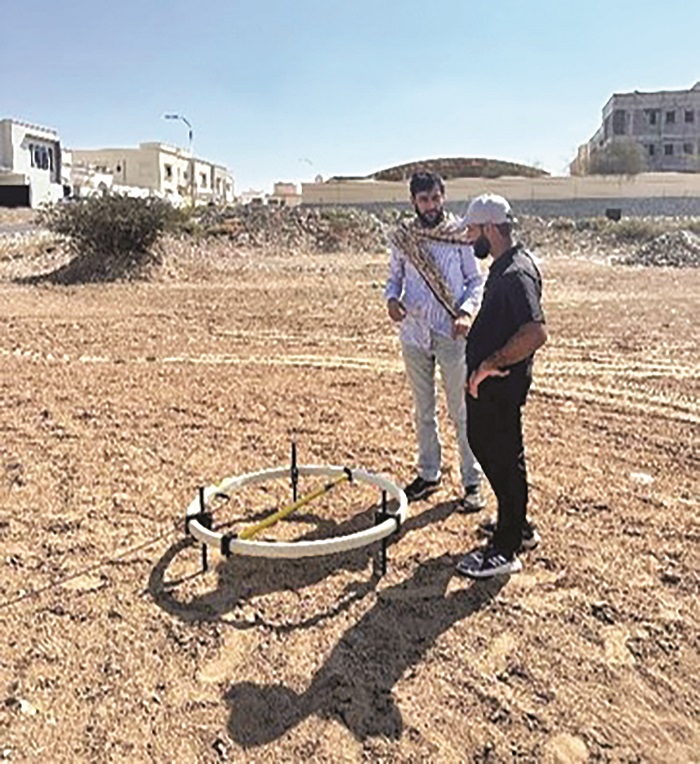
MUSCAT: A recent geophysical study by researchers at Sultan Qaboos University (SQU) has provided new insights into the extent of seawater intrusion into a coastal aquifer in northern Oman, highlighting the need for advanced monitoring to protect the Sultanate’s groundwater resources.
The study, titled “Imaging of Seawater Intrusion in a Coastal Alluvial Aquifer Using Transient Electromagnetic Data and Laterally Constrained Inversion in Northern Oman,” was led by Dr Muhammad Younis Khan, Assistant Professor of Applied Geophysics in the Department of Earth Sciences, College of Science at SQU.
Groundwater is one of Oman’s most valuable natural resources, but coastal aquifers are increasingly threatened by seawater intrusion, driven by excessive groundwater extraction and changing environmental conditions.
Dr Khan said the deterioration in groundwater quality has resulted in the abandonment of wells and affected economically important crops, including date palms.
The study focused on the Al Jifnain area between Al Jifnain Dam and the Sea of Oman.
It sought to determine the extent of seawater intrusion and develop a more reliable method of distinguishing freshwater from saline groundwater, providing scientific information to support sustainable groundwater management.
The research team used the Transient Electromagnetic (TEM) method combined with Laterally Constrained Inversion (LCI) to produce detailed images of subsurface conditions. The models identified the main layers of the coastal aquifer system, including unsaturated near-surface gravels, a freshwater-bearing gravel aquifer and localised clay-rich layers.
Most significantly, the researchers identified a large, wedge-shaped body of highly conductive material, interpreted as seawater intrusion. The intrusion extends inland from the coast, with its greatest thickness near the shoreline and gradually thinning farther inland.
Clearer identification
According to Dr Khan, combining TEM with LCI produced more continuous and geologically realistic subsurface images than conventional processing methods. The approach enabled clearer identification of the freshwater aquifer, seawater intrusion and clay-rich layers.
The findings provide a detailed geophysical assessment of groundwater conditions in Al Jifnain and establish an important scientific baseline for monitoring changes in seawater intrusion over time.
The study could also support assessments of managed aquifer recharge and its long-term effectiveness in protecting freshwater resources in the area.
Dr Khan recommended establishing a long-term groundwater monitoring programme using repeated TEM surveys alongside groundwater-level and hydrochemical measurements.
He also called for geophysical monitoring to be integrated with groundwater-flow and numerical modelling to assess the long-term benefits of managed aquifer recharge from Al Jifnain Dam.
In addition, the researchers recommended high-resolution airborne electromagnetic surveys to develop detailed three-dimensional maps of groundwater salinity and provide further information on the area’s hydrogeological conditions.
Such measures could support evidence-based groundwater management and policy decisions aimed at reducing seawater intrusion and protecting freshwater supplies.
The research also contributes to the United Nations Sustainable Development Goal on Clean Water and Sanitation by improving understanding of seawater intrusion and supporting the sustainable use of freshwater resources.
Published in Water, an international peer-reviewed Q1 scientific journal, the study was conducted by Dr Muhammad Younis Khan, Dr Talal Al Hosni, Prof Osman Abdalla, Bader Al Shaqsi, Dr Hai Li and Dr Ahmed M. Beshr.