Sunday 26 / July / 2026
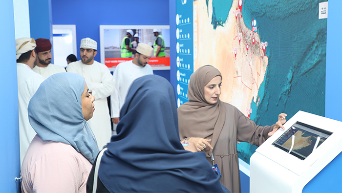
Muscat: The Public Authority for Special Economic Zones and Free Zones (Opaz) introduced the OMAP platform during its participation in the Comex Technology Show 2024, taking place from May 27 to 30,
This platform comprises integrated geographical maps of all broad plans for special economic zones, free zones and industrial cities overseen by Opaz.
Visitors interacted with the OMAP platform during Comex 2024, as its simplicity of use and availability of geographic data attracted interest. There was an increase in both the quantity and frequency of users interacting with the platform, according to data collected through the third day. The interaction indicated the satisfaction of users with the platform's experience and reiterated that the OMAP platform could fulfil their needs.
Najia bint Sultan Al-Hajriya, Head of Opaz Geographic Information Systems, stated that the Omap platform offers much functionality that facilitate the search for certain sites or plots for investment. The platform provides detailed information on vital landmarks and facilities such as hospitals, restaurants, schools, shops, and hotels, which users can find based on their current location or the location chosen. The details of the plots, including the type of activity, usufruct rates, Location coordinates, the area, and the surrounding public services such as electricity, communications, water, and public and private transport networks that are in the vicinity can also be enquired about by users.
With this platform, one can measure the distances between various locations, for example, the distance between a plot and the transportation networks that transport goods and products to international markets.
The measurement tool, the planning and sketching tool, and the map writing tool are just a few of the many tools that users can utilize on the platform, according to Al-Hajriya. These tools also include the Location Selection Tool, the Print Map Tool, the Sketch Creation Tool, and the Nearby Services Search Tool. With the help of these technologies, users can digitally capture coordinates, and the platform will interactively drop the spot on maps.
She emphasised the many benefits the platform offers users, including the ability to locate various sites for biodiversity, natural reserves, tourist destinations, and camping areas. Because the platform is integrated with the systems of local climate monitoring stations, users may also view the weather and climatic conditions. Access to soil investigation data for various sites in the Special Economic Zone at Duqm —a testing ground for AI and future technologies—is also made possible via the platform.
Significantly, the platform was introduced in September 2023 as part of the Authority's efforts to improve the quality of services offered to investors by expediting and streamlining procedures, cutting down on time and effort, offering opportunities to all investors and beneficiaries, and making sure that plans do not overlap. With the help of intricate interactive maps of every area under the Authority's supervision, the system guarantees simple access to precise and comprehensive spatial data. It also helps identify areas that are available for investment and other relevant economic activity.