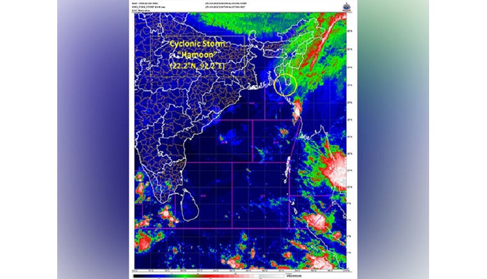
Bangladesh: Cyclonic Storm 'Hamoon' over coastal Bangladesh has commenced the landfall process and is set to weaken into a deep depression during the next six hours, according to the India Meteorological Department (IMD).
"The Cyclonic Storm Hamoon over coastal Bangladesh lay centered at 0530 hours IST of 25th Oct about 40 km east-southeast of Chittagong (Bangladesh)," the weather department said today adding that it was proceeding with "a wind speed of 80 to 90 kmph gusting to 100 kmph," the IMD posted on X.
It is predicted to move north eastwards and weaken into a deep depression during next six hours and further into a depression during subsequent six hours, it said.
On Tuesday a 'storm warning cage number 2' was mounted at Pamban Port in Rameswaram to warn fishermen about the Severe Cyclonic Storm 'Hamoon' over the Bay of Bengal, port officials.
Odisha administration had on Monday put all Urban Local Bodies (ULB) on alert in view of the formation of cyclonic storm 'Hamoon' in the Bay of Bengal.
Meanwhile, the Severe Cyclonic Storm 'TEJ' over coastal Yemen weakened into cyclonic storm at 1130 IST on October 24, the MeT Department stated on Tuesday that it will move further west-northwestwards and weaken into a depression during next six hours.
Also, Light to moderate rainfall is very likely at many places with isolated heavy rainfall over Mizoram on October 25.
Light to moderate rainfall is likely at many places over Mizoram and Tripura for Thursday. Light to moderate rainfall is very likely at many places over Nagaland, Manipur and east Arunachal Pradesh on Wednesday and Thursday.
Fishermen are advised not to venture into the Northeast Bay of Bengal and along and off Bangladesh and north Myanmar coasts till October 25 and adjoining areas of northwest Bay of Bengal and Eastcentral Bay of Bengal till Wednesday afternoon, according to a bulletin by the India MeT department.